HERE Technologies
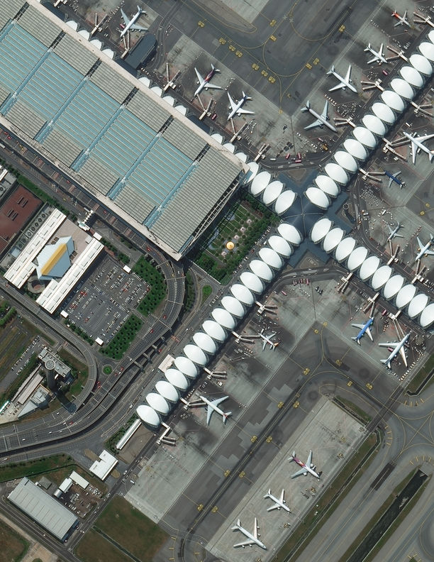
Utilizing Maxar satellite imagery for automated map making at scale
As a partner to innovative businesses and 50 governments, Maxar helps visionaries—big and small—look for new ways to understand our planet and move humanity forward.
At Maxar, we turn big ideas into successful missions that monitor change on Earth. See why governments, businesses and partners across the globe work with Maxar to solve diverse and complex challenges.
Utilizing Maxar satellite imagery for automated map making at scale
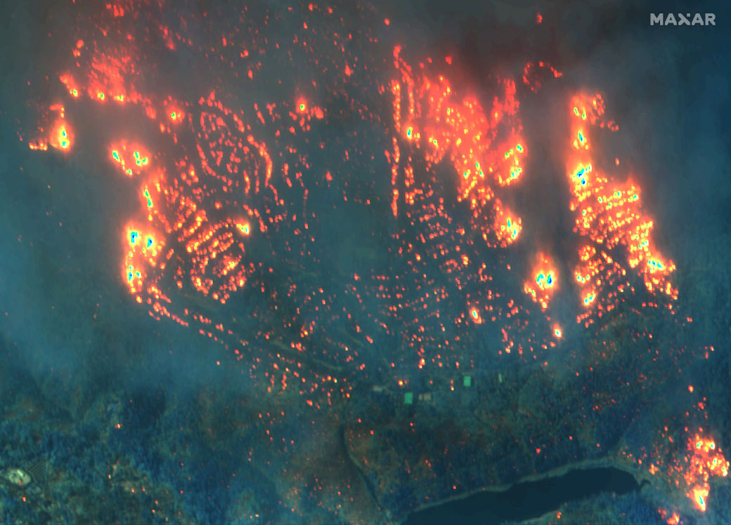

Using AI to automatically assess property characteristics to identify and mitigate wildfire risk


Times of crisis are defined by seconds and minutes, not days and months. The Maxar-developed [Remote Ground Terminal] is significantly enhancing the speed at which we access critical information at the tactical edge and provides an important technology advancement for enabling [Tactical Intelligence Targeting Access Node].
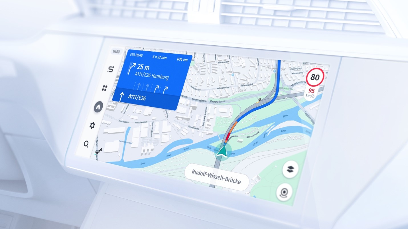
Maxar’s satellite imagery helps us push the boundaries of automated map making at global scale. By combining numerous data sources, including vehicle sensor data and Maxar’s global satellite imagery, we’re able to provide our customers in the automotive, transportation and logistics, mobility, manufacturing and retail industries with a highly precise and actionable ground-truth view of the world.
Maxar’s recently expanded capacity with the new WorldView Legion satellites creates new opportunities for us to reliably collect fresh, very high-resolution satellite imagery along our customers’ rights-of-way to analyze for vegetation encroachment. Our customers will benefit from the high-quality of Maxar’s imagery as value-added products like our vegetation risk assessments improve with better input data.
Partners are essential to serving our customers across the globe, ranging from large governmental agencies to established companies and innovative startups. Our partners develop, market and sell geospatial products, solutions and services derived from our market-leading optical satellites to solve customers' most pressing problems.
Explore the products and capabilities that make these outcomes possible.
Learn more