Precision3D™ Registration (P3DR)

Leading-edge georegistration for unparalleled accuracy in real time

Sources for 3D data are expanding daily as satellites provide new geospatial data to interpret, analyze and share. How can users ensure what they are viewing is precisely located? And, for more sophisticated users, how can they fuse disparate sources of information?

For sensor data to align with the real world, it must be georegistered.

Current methods of precise 3D measurements rely on stereo images. These are labor intensive and can't always measure the vertical information where you need it. In addition, a manual process is then often necessary to complete the alignment of the new sensor to the position data.

Maxar Intelligence's Precision3D™ Registration (P3DR®) leverages our industry- leading Precision3D Globe in 3D combined with full-automated algorithms to quickly and accurately georegister your sensor data, anywhere.

Graphical overlay on a 3D image of a coastline and body of water.

P3DR

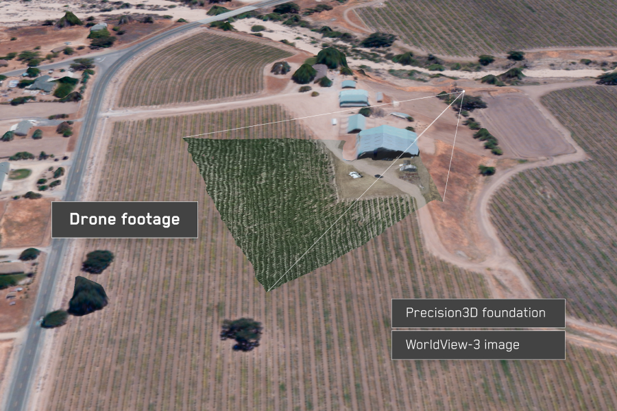
P3DR is a stand-alone software solution to automatically georegister imagery to Maxar’s Precision3D foundational globe. Using the worldwide Precision3D foundation with resolution of 50 cm or better and 3 m accuracy in all dimensions, P3DR allows new satellite imagery to inherit this same absolute positional accuracy as the Precision3D foundation. Our accuracy is as good in Pyongyang, Moscow, Beijing or Tehran as it is in London or New York.

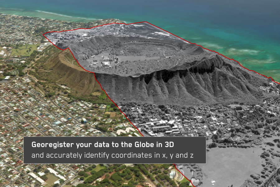
  • Proven in operational environments. P3DR automatically aligns new imagery to 3 m-accurate (in x, y and z) Precision3D data
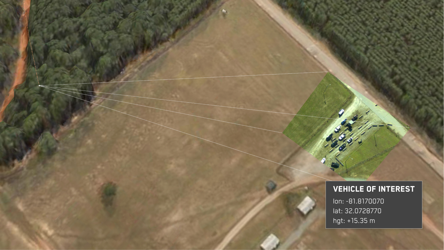
  • Enables real-time sensor fusion. Data from each available platform and sensor is automatically aligned by being registered to the Precision3D foundational data
  • Accomplish real-time georegistration of imagery that correlates your sensor data with Maxar’s Precision3D™ data. This enables accurate coordinate mensuration without ground control points.
  • Carry out accurate georegistration of both nadir and oblique imagery
Graphic 3D overlay of an urban area over another image of an urban area

Full-motion video

Need to georegister single frames or full-motion video feeds? Check out the companion Raptor Sync™ software product that complements P3DR’s satellite registration capability. Raptor Sync also uses Precision3D reference data, making it possible to co-register satellite and aerial video data to the same authoritative 3D foundation.

Text box overlaid on a graphic design including 3D imagery

Satellite and reconnaissance pod imagery

There are many ways to tailor the P3DR solution to meet your satellite imagery needs. Integrate P3DR® with your servers for 24/7 batch processing of large amounts of imagery from satellite electro-optical sensors. Customize P3DR installation to process images immediately after downlinking or georegister archived images. P3DR requires no manual labor or human touch. Maxar’s P3DR-enabled Precision3D Explorer software can be tailored to your specific workflow and needs.

See for yourself

See firsthand how you can automatically georegister imagery with P3DR.

Request a demo