SOLUTIONS
FOR ENERGY

Stay ahead of risks and optimize operations
with advanced geospatial data and insights

Maintain a current
operational view

Maxar Intelligence provides foundational insights into conditions on the ground, without the expense and risk of sending teams to locations. Maxar’s enterprise solutions integrate seamlessly into leading oil and gas applications.

A COMPREHENSIVE SOLUTION TO THE MOST
PRESSING CHALLENGES

Aerial view of an oil and gas production site with equipment, storage ponds, and surrounding arid landscape, illustrating operational optimization.

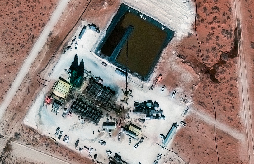
Operational optimization

Explore and assess new locations and scale plans to increase oil and gas production.
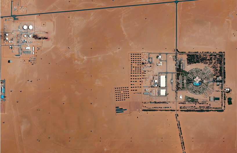
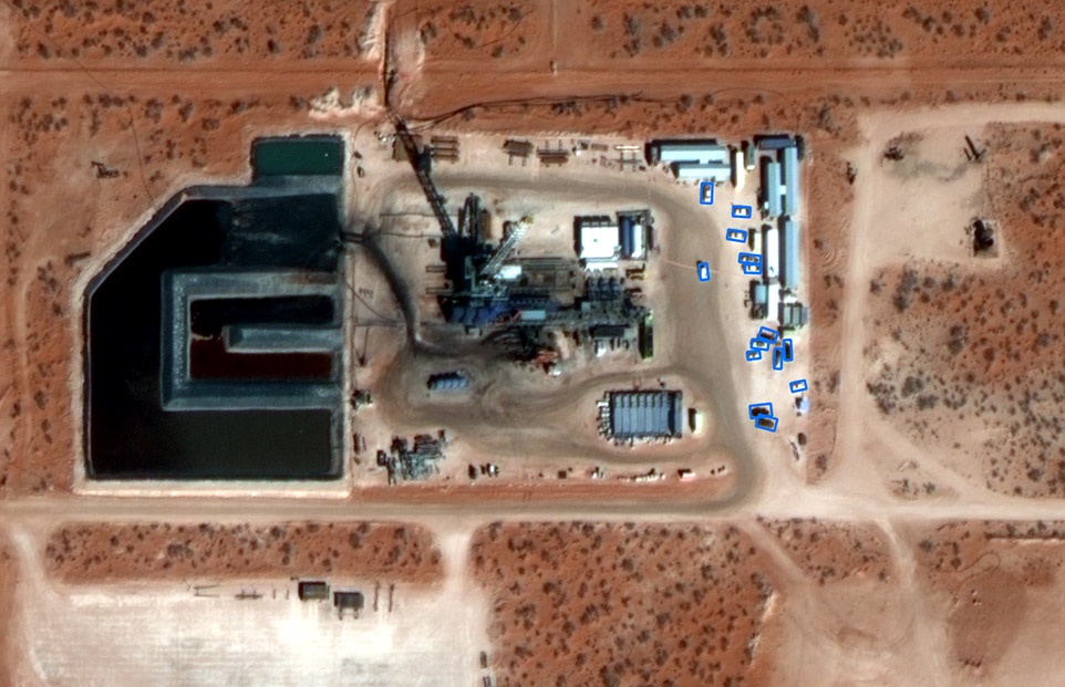
Satellite image of a large-scale oil and gas field with multiple well pads, processing facilities, and storage tanks in a desert region, highlighting remote monitoring capabilities.

Remote monitoring

Keep an eye on sites at scale and deploy crews only when necessary to perform maintenance or take mitigation steps.
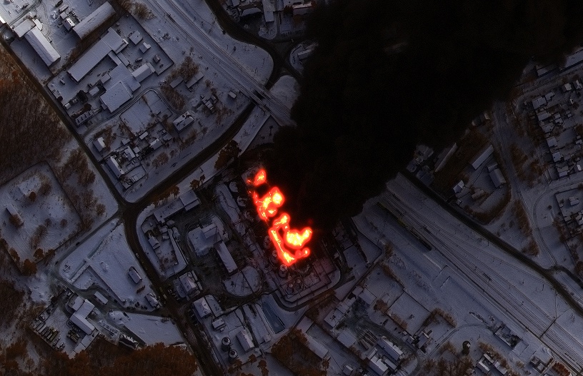
Satellite view of an industrial facility at night with visible thermal anomalies (red areas indicating potential heat or emergencies), illustrating risk mitigation through condition monitoring.

Risk mitigation

Safeguard your operations by understanding changing conditions to plan for and respond to emergencies.

Aerial image of a landscape with a road or pipeline crossing through wetlands and vegetation, representing regulatory compliance with environmental health and safety.

Regulatory compliance

Adhere to strict environmental health and safety regulations at both the state and federal levels.

PRODUCTS

Aerial view of an active onshore oil and gas well site with equipment, storage ponds, and surrounding desert terrain, illustrating real-time monitoring capabilities.

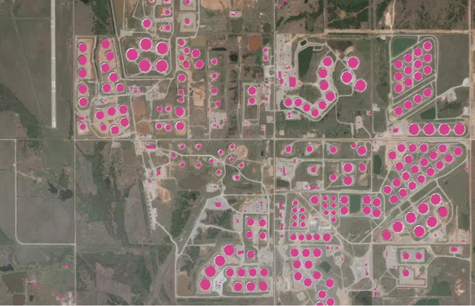
Real-Time Monitoring

Automatically monitor onshore and offshore energy assets with geospatial insights.

See how

Spatial on Demand®

A plug-and-play enterprise solution of current Maxar imagery and data, curated third-party geospatial content and custom data hosting, streamed directly into your GIS applications.

Integrate data off-the-shelf

Aerial view of an active onshore oil and gas well site with equipment, storage ponds, and surrounding desert terrain, illustrating real-time monitoring capabilities.
Satellite view of the Kashagan Field, a large offshore oil and gas development with artificial islands and connecting infrastructure in the Caspian Sea.

Maxar® Geospatial Platform (MGP)

Access and download satellite imagery from Maxar’s 125+ petabyte archive and daily collections through MGP Pro.

Explore Imagery

Imagery tasking

Task the Maxar constellation for custom satellite imagery collections to ensure imagery meets operational and regulatory requirements.
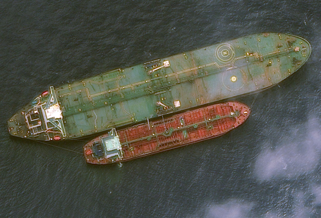
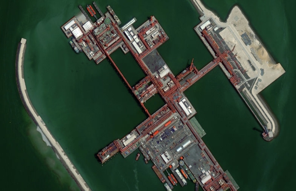
Learn more

High-resolution aerial view of an industrial or energy facility with multiple storage tanks, buildings, and vehicles, illustrating the level of detail achievable through custom satellite imagery tasking.
Aerial view of two oil tankers anchored in dark water, illustrating offshore asset monitoring for regulatory compliance and risk mitigation.

CROW´ S NEST

Maintain a current view of offshore drilling assets to adhere to local regulations, understand key risks and quickly deploy resources to mitigate any environmental issues.

Learn more

Resources

View more

Start a conversation with our sales team

From mapping to monitoring, streamline your workflows and
keep your assets safe with geospatial data and insights.