Raptor™
Next-gen GPS resilience for autonomous systems
Powerful platform-agnostic software enables accurate drone navigation and coordinate extraction without GPS, unlocking autonomy at scale from the digital battlefield to the connected city.

Resilience for
Every Mission
Raptor is a suite of vision-based software products that transform the resilience and reliability of unmanned systems, enabling autonomy at scale across warfighting, humanitarian and commercial operations for customers across the world.
Designed for lightweight integration with any autonomous platform, Raptor uses only a drone’s native camera and Maxar’s 90 million-plus sq km of global 3D terrain data to help the platform navigate with extreme precision and extract accurate ground coordinates in real-time without GPS.
Raptor can also operate at night and in low-terrain environments. No additional hardware required.

Easily deployable on any platform.
no extra hardware required.

Extreme precision
and accuracy
Raptor solutions have demonstrated absolute accuracy of <7 m RMSE for determining the UAV's aerial position and absolute accuracy of within 3 m for ground coordinate extraction.
Supports complex
mission profiles
Built on a true 3D representation of the operational terrain, Raptor products operate at night, in any season, and at altitudes as low as 120 m.

Enables autonomy
at scale
Raptor anchors sensor data against a common geospatial foundation, makes it possible for different unmanned systems to work together for joint operations.

Draws on unique
3D terrain data
Raptor products all draw from Maxar’s 90M+ sq km of highly accurate 3D terrain data (3 m SE90 accuracy), which is regularly updated to provide a reliable view of the operational terrain.

Power-efficient, existing camera, lightweight integration
These solutions are platform-agnostic and can use the drone’s existing camera. They’re easy to bring online, deployable on low-power commodity hardware.
Raptor PRODUCT SUITE
Navigate with certainty
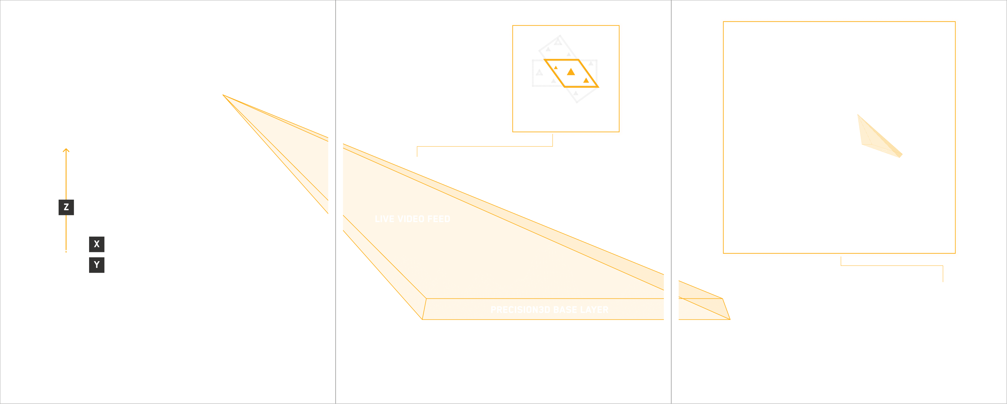
Vision-based positioning software loaded directly onto the drone that enables the platform to determine its aerial position with demonstrated absolute accuracy of <10 m RMSE. The software works with commodity on-board camera systems, using the camera's live video feed, Maxar's 3-meter accurate Precision3D terrain data and proprietary algorithms to determine the drone's position, feeding that data to the drone's navigation system.
Unify your view
Software that georegisters the full motion video feed from the drone’s on-board camera with Maxar's 3D terrain data in real-time, enabling intelligence fusion, multi-domain interoperability across different sensors and accurate coordinate extraction at a demonstrated absolute accuracy of <3 m.
Operate with accuracy
Software solution installed on commodity laptop equipment that works alongside drone controllers, enabling operators to extract real-time target ground coordinates from full-motion aerial video feeds with a demonstrated absolute accuracy of <3 m.
How it works
FROM THE DIGITAL BATTLEFIELD TO THE CONNECTED CITY
01.
Joint multi-domain operations
Raptor can help realize the vision of a digital battlefield, ensuring autonomous systems work in unison to deliver on surveillance, reconnaissance and tactical operations. No GPS needed.
02.
Large-scale autonomous delivery systems
Commercial logistics companies are building large-scaled autonomous delivery systems. With Raptor, urban canyons are no longer a barrier to reliability, and drones can drop off packages with precision at scale.
03.
Search and rescue
Raptor can help first responders deliver aid drops with precision to even the smallest landing zone. No matter where, no matter the situation.
Schedule a custom demo with a Maxar sales representative