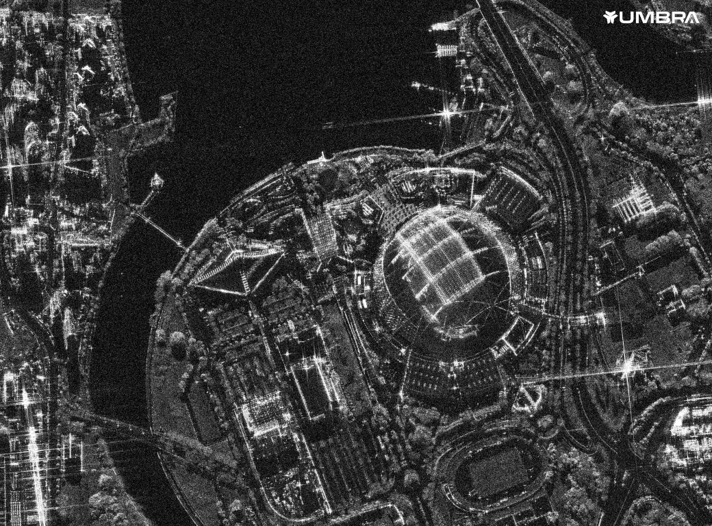
Detect change and build context at scale
Satellite imagery is a critical tool for visualizing ground conditions. Whether you need a foundational map for an app or a comprehensive dataset for business intelligence, Maxar offers both fresh high-resolution imagery and the world’s largest archive for historical analysis.
Maxar’s Earth observation constellation offers the most comprehensive suite of commercial satellite imagery; our diversity in resolution, currency, spectral bands, and accuracy helps industries conserve resources, expedite operations, ensure compliance and save lives.
Learn moreMaxar’s imagery mosaics provide a stunning, virtually seamless, high-resolution image basemap over large areas. By stitching together our best imagery into a single layer, we provide an accurate, consistent, actionable satellite imagery layer to support mapping, visualization, and analytics at local, regional, and global scale.
Learn moreMaxar ARD enables users to skip straight to analysis with preprocessed time-series stacks of satellite imagery that are ideal for change detection, mapping and monitoring.
Learn moreDetect change through inclement ground conditions and at night with radar imagery. This type of imagery can penetrate clouds and darkness—delivering uniquely reliable monitoring capabilities to civil, commercial and defense organizations around the world.
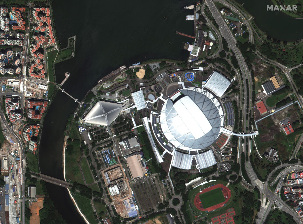
Use the slider to compare optical imagery with radar imagery.
RADARSAT-2 Data and Products © MDA Geospatial Services Inc. (2019) - All Rights Reserved. RADARSAT is an official mark of the Canadian Space Agency.
Learn moreFor organizations with ongoing geospatial needs or who want to integrate data into their workflows, our subscriptions provide constant access to recent imagery and geospatial data.
SecureWatch® is the premier cloud-based subscription service for secure and timely access to Earth Intelligence, simplifying your ability to map, monitor and detect change for any location on the globe at a moment’s notice.
Learn moreSee the difference the highest quality satellite imagery can make for your project.
Download samples