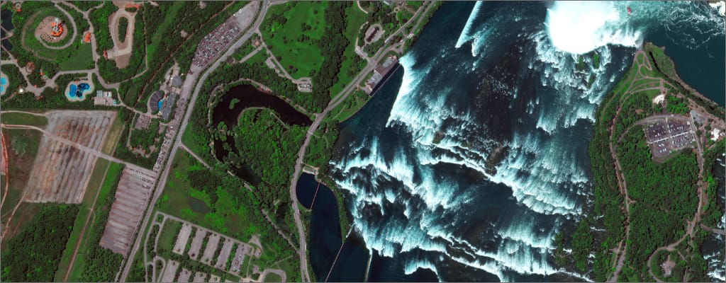
Use Cases

Empowering customers to reach new frontiers

Explore

Space exploration involves a pioneering mindset, grand ambitions and the ingenuity to overcome complex challenges. It also involves real constraints like budget, resources, time and distance. Discover how commercial innovation is reshaping the way we access and explore space.

Resilient performance for mission success

Expanding the aperture on where and how we explore requires an integrated approach to mission design and execution. Maximize your investment and ensure mission success by choosing one of Maxar’s versatile and proven spacecraft platforms—with industry-leading design, engineering and testing.

Spacecraft

Versatile spacecraft for dynamic missions

Governments and commercial organizations worldwide count on Maxar to reliably meet their diverse technical requirements. Our flexible and affordable spacecraft platforms serve an array of missions and feature a modular approach to design for a precision build with less excess.

Learn more

Propulsion

Next-generation propulsion

As we set our sights on missions further from home and crewed by humans, sustainability takes on a new meaning. Missions beyond low Earth orbit require new technologies for travel, communication and survival. Our experience in electric propulsion is key to moving large equipment long distances.

Learn more

Robotics and servicing

Robotics and automation for remote operations

On-orbit servicing, assembly and manufacturing are revolutionizing space operations and exploration. Our robotics extend mission lives, enable the use of larger components and advance exploration in space for more sustained manned and un-manned missions that transform what we can do and learn.

Learn more

Connect

From smartphones to smart-homes and the future of IoT visions like precision health and autonomous vehicles—our reliance on fast, secure connectivity and communications will only continue to grow.

Communication from and across space

Maxar has been expanding the power and reach of satellite communications since the 1950s. From high-speed internet and real-time access to satellites orbiting the Earth to critical spacecraft communications, we can help you connect what matters.

Internet connectivity

How does Indonesia deliver reliable, broad-based and affordable broadband to the most remote islands and villages throughout the archipelago? With its first high throughput satellite built by Maxar, equipped with C-band and Ku-band transponders for voice and data communications and video distribution.

Learn more

Downlink on demand

In times of crisis, every moment counts—and if you work with geospatial data, you need the ability to downlink and disseminate satellite data quickly.

Learn more

Space-based communications

Together with NASA, Maxar is developing an advanced optical communications and enhanced radio frequency architecture that will introduce a new realm of possibilities for scientific and human exploration missions in Earth orbit, at the Moon and throughout the solar system by the mid-2020s.

Learn more

Access

Keep pace with change by choosing a reliable source for accurate, current and global geospatial data.

Comprehensive data for global solutions

Enrich intelligence by integrating multiple data sources, like weather or human geography information, that can help you build a more complete perspective to inform critical decisions. We can help you simplify access to diverse datasets and expedite analysis. 
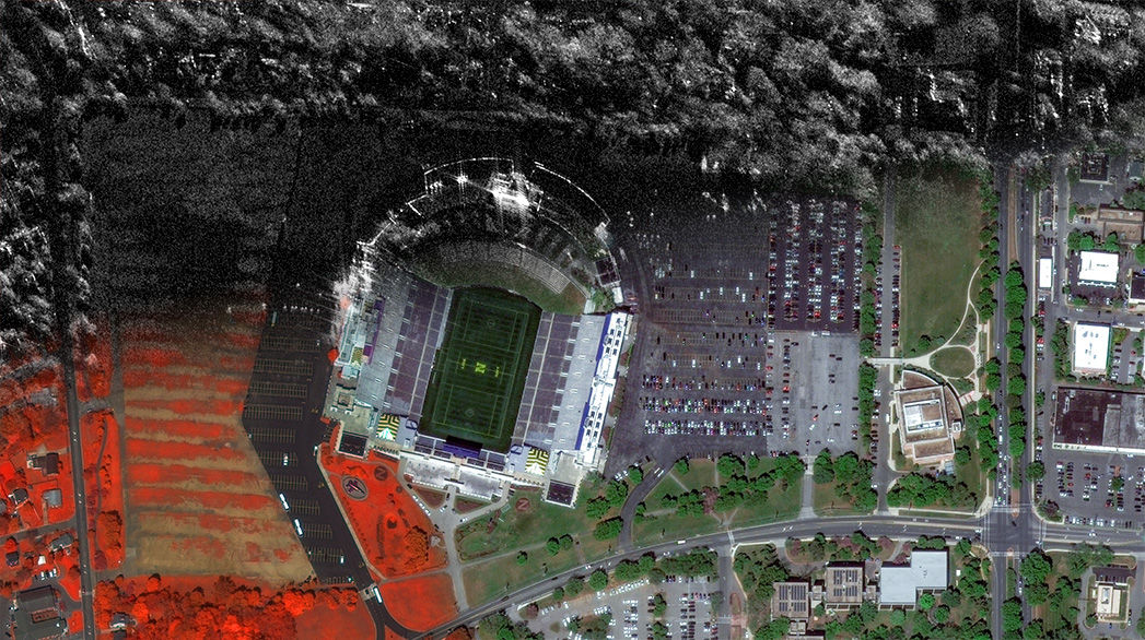
Maxar’s satellite constellation

Our unique flexibility in resolution, spectral diversity and collection capacity helps innovative industries conserve resources, expedite operations, improve compliance and save lives.   

Learn more

A living global image library

We collect more than one billion sq km of high-resolution imagery per year, building and refreshing the most comprehensive and up-to-date high-resolution imagery library in the world as well as offering tremendous tasking capacity for specialized missions.  

Learn more

From imagery to insights

Access the actionable information you need, when you need it, the way you need it—online, offline, on your mobile device or directly into your GIS—from industry-leading experts leveraging multiple data sources, innovative tools, technology and tradecraft.   

Learn more

Map

Maps are foundational tools that help first responders identify viable routes, analysts predict conflict, consumers navigate rapidly changing cities and more.

Start with the right foundation

There are many ways to read a mapand even more ways to build one. Whether a map is central to your project or simply for visual context, Maxar offers best-in-class imagery, privacy and flexibility to develop new applications or integrate into existing workflows.

Innovation for business and customers

Customers rely on Maxar’s high-resolution satellite imagery to keep their applications up to date and continuously complete unmapped or outdated areas of large cities, enabling better business.

Learn more

Evolving next-gen mapping technology

From hand-drawn paper maps to dynamic real-time digital views of the Earth, the mapping industry is rapidly changing. And we're helping our partners thrive at the forefront of this opportunity.

Learn more

Providing geospatial context

Imagery basemaps, vector data, 3D building footprintseach of these datasets can provide valuable context for business decisions and operations. Not sure what you need or how to use it? Explore example use cases with our interactive map.

Explore data

Analyze

Collection and access to exponential amounts of geospatial data have governments, commercial and global development organizations struggling to extract and apply meaningful insights. But Maxar analytics can help.

AI-driven analytics

As the source and experts in multisource geospatial content, we have developed leading-edge analytics fueled by machine learning to reveal useful patterns in massive amounts of data–helping customers reduce resources while increasing scale and speed.

The power of the crowd

Our crowdsourcing platform utilizes the collective intelligence of a verified crowd and geospatial analysts to provide fast and accurate feature assessment. In the wake of Hurricane Dorian, Maxar helped the Bahamian government assess areas and prioritize recovery efforts.

Learn more

The future of location intelligence

Are you missing geographic context? By combining the best imagery content, cloud computing and machine learning available, we help partners capture and understand critical location intelligence to improve decisions.

Learn more

Analytics with the right tech, tools and talent

Through our integrated capabilities, Maxar has the right resources to unlock Earth intelligence at a global scale. By combining change detection, object detection and predictive analytics, we deliver insights as a service to help customers quickly and effectively identify and address challenges.

Learn more

Empowering industry transformation

Maxar serves dozens of industries worldwide, from environmental monitoring and mapping to defense and public safety. 

Find out more